BILASPUR (Plan showing British and Goorkha postions in the territory Between Belspoor, Nalaghur. Muckewal and Irkee).Drawn by G. Hutchinson from the original by Lt. P Lawtie 1821.
| Department | Survey Of India (Maps) |
| From Year / Date (YYYY-MM-DD) |
1821 |
| To Year / Date (YYYY-MM-DD) |
1821 |
| Place | Bilaspur |
| Series | Historical Maps |
| Identifier | CR_000002286559 |
| File No. | F10-10 |
| Scale | 1 - 1.1/4. miles |
| File Size | 4.8 MB |
| Pages | 1 |
| Collection | Digitized Cartographic Records |
| Series | Historical Maps |
-
621 views
Other Similar Items
-
- 327 Views
- Correspondence regading the Naresh Kot Radha Kisha...
- Department: Foreign and Political
- Branch: External-B
- Year / Date: 1914
-
- 504 Views
- Request made by the Resident in Waziristan for the...
- Department: Foreign
- Branch: Frontier-B
- Year / Date: 1893
-
- 386 Views
- India Size of maps 21, 21A: 30.0 cm x 36.0 cm; map...
- Department: Survey Of India (Maps)
-
- 430 Views
- Publication of Mr. C.A. Sherring's book entitled W...
- Department: Foreign
- Branch: External-B
- Year / Date: 1906
-
- 699 Views
- Supply of 5 copies of the Report on the Reconnaiss...
- Department: Foreign
- Branch: External-B
- Year / Date: 1892
-
- 450 Views
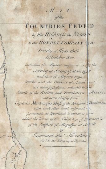
- hyderabad Size: 61 cm x122cm , between borders; si...
- Department: Survey Of India
-
- 390 Views
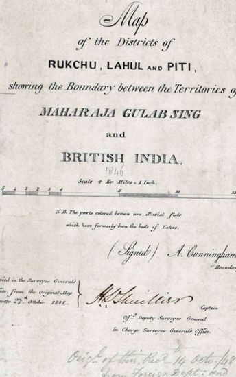
- Kashmir Size 51.1 cm x 63. 3 cm, between borders; ...
- Department: Survey Of India (Maps)
-
- 230 Views
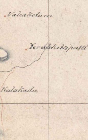
- Tinnevelly Size: 87 cmx 29 cm, between borders; in...
- Department: Survey Of India (Maps)
-
- 252 Views
- 1) Change in the name of Railway Station Koliwada ...
- Department: Ministry of Railway
- Branch: Accounts III
- Year / Date: 1968
-
- 163 Views
- Change in the name of Village Mayuram as Mayiladut...
- Department: Ministry of Railway
- Branch: Accounts III
- Year / Date: 1968