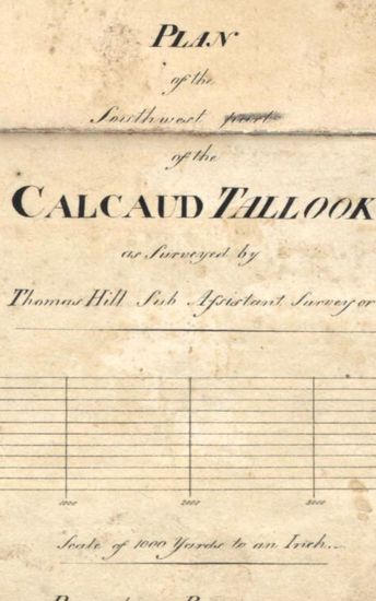
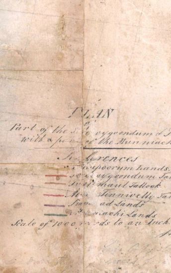
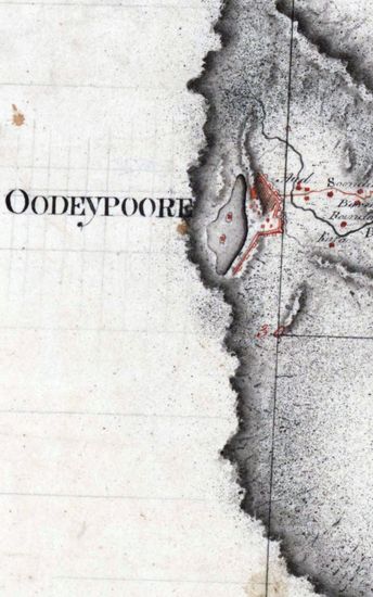
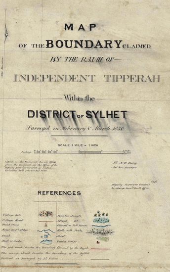
Tinnevelly Size: 65 cm x 81 cm, actual areas ;in one sheet . No coordinates marked or numbered ; hand -drawn and sparsely coloured; boundaries ribbon -coloured; cultivated areas shown as rectangles with grey and black lines; forests marked with trees drawn in black with shadows on the east; relief shown by grey tint and roads in thick single lines of burnt sienna; blank areas appear; and tiangulation lines in black ink with distances in feet. A neatly finished map. Watermark:J WHATMAN 1801.
| Department | Survey Of India (Maps) |
| From Year / Date (YYYY-MM-DD) |
1801 |
| To Year / Date (YYYY-MM-DD) |
1801 |
| Place | Tinnevelly |
| Series | Cartographic Notes |
| Identifier | CR_000002286489 |
| File No. | 1801-20-19(M) |
| Scale | 65 cm x 81 cm, |
| File Size | 5.7 MB |
| Pages | 1 |
| Collection | Digitized Cartographic Records |
| Series | Cartographic Notes |
-
261 views
Other Similar Items
-
- 341 Views
- Tinnevelly Size: 97cm x 100.5 cm , actual area; tw...
- Department: Survey Of India (Maps)
- Year / Date: 1810
-
- 289 Views

- Tinnevelly Size: 79 cm x 57.5 cm , actual areas th...
- Department: Survey Of India (Maps)
- Year / Date: 1805
-
- 286 Views
- Tinnevelly Size: 77cmx 83 cm, actual areas ; four ...
- Department: Survey Of India
- Year / Date: 1805
-
- 282 Views
- Khandesh Size 210cm x 189.5cm , actual areas, 10 s...
- Department: Survey Of India
-
- 226 Views

- Goa Size: 91.5 cm x62.5 cm, betwwen borders; in on...
- Department: Survey Of India
- Year / Date: 1811
-
- 273 Views

- Tinnevelly Size: 80 cm x 89.5 cm, actual areas; in...
- Department: Survey Of India
- Year / Date: 1811
-
- 343 Views

- Tinnevelly Size: 80 cm x 96cm,actual area; five sh...
- Department: Survey Of India (Maps)
- Year / Date: 1810
-
- 319 Views
- Tinnevelly Size: 73cmx 54cm ,actual areas; in one ...
- Department: Survey Of India (Maps)
- Year / Date: 1805
-
- 377 Views

- Tinnevelly Size: 80.5 cm x 66cm, actual areas tree...
- Department: Survey Of India
- Year / Date: 1805
-
- 318 Views
- Sylhet Size: 98.3 cm x 91.5 cm, between borders; i...
- Department: Survey Of India (Maps)