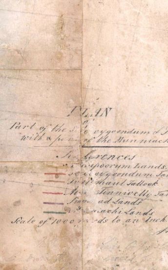
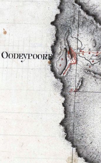
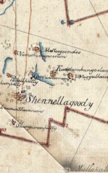
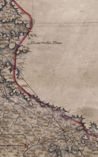
Tinnevelly Size: 87 cmx 29 cm, between borders; in one sheet. Parallels from 8 Nto 10 N and meridians from 77 10 'E to77 50 E marked and numbered ; hand- drawn and coloured; general conventional sign used to show toppograhical feautures; mountains shown with grey tintand roads in single lines of burnt sienna.
| Department | Survey Of India (Maps) |
| Place | Tinnevelly |
| Series | Cartographic Notes |
| Identifier | CR_000002286494 |
| File No. | 1801-20-21 |
| Scale | 87 cmx 29 cm |
| File Size | 3.1 MB |
| Pages | 1 |
| Collection | Digitized Cartographic Records |
| Series | Cartographic Notes |
-
230 views
Other Similar Items
-
- 344 Views

- Dindigul Sizes of various sections very between 33...
- Department: Survey Of India (Maps)
-
- 286 Views
- Tinnevelly Size: 77cmx 83 cm, actual areas ; four ...
- Department: Survey Of India
- Year / Date: 1805
-
- 282 Views
- Khandesh Size 210cm x 189.5cm , actual areas, 10 s...
- Department: Survey Of India
-
- 319 Views
- Tinnevelly Size: 73cmx 54cm ,actual areas; in one ...
- Department: Survey Of India (Maps)
- Year / Date: 1805
-
- 249 Views
- Tinnevelly Size: 37 cmX 48 cm, actual areas; three...
- Department: Survey Of India
- Year / Date: 1801
-
- 276 Views
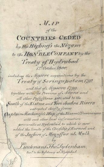
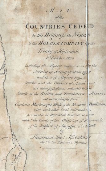
- Hyderabad Size: 91.5 cmx 102.5cm, between borders;...
- Department: Survey Of India
-
- 318 Views
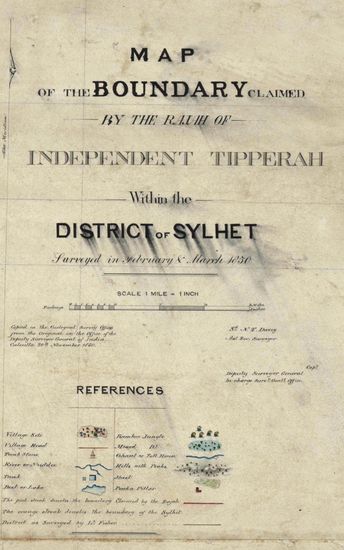
- Sylhet Size: 98.3 cm x 91.5 cm, between borders; i...
- Department: Survey Of India (Maps)
-
- 450 Views
- hyderabad Size: 61 cm x122cm , between borders; si...
- Department: Survey Of India
-
- 390 Views
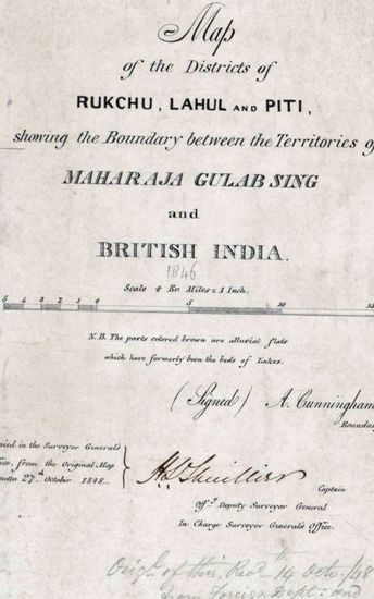
- Kashmir Size 51.1 cm x 63. 3 cm, between borders; ...
- Department: Survey Of India (Maps)
-
- 295 Views
- Hyderabad Size of the map , in 5 sections, is 110 ...
- Department: Survey Of India (Maps)