16 Items found in 0.01 seconds
Results
-
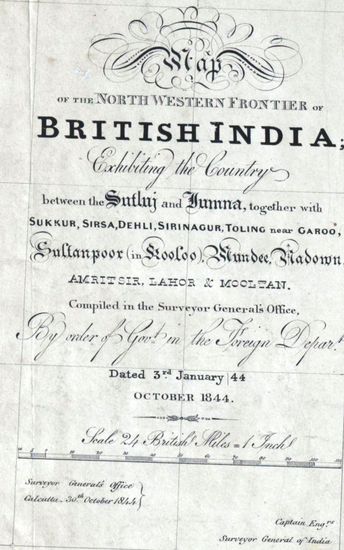
- PUNJAB Map of the Norethern Frontier of British India exhibiting the Country between the Sutlej and Jumna together with Sukkur, Sirsa, Delhi, Srinagur, Toling near Garoo, Sultanpoor, in Kooloo Mundee, Nadown, Amritsir, Lahore, and Mooltan, Compiled in 1844.
- Department: Survey Of India (Maps)
- Year: 1844
- Place : Punjab
- Digitized Collection : Digitized Cartographic Records
- Held by : National Archives of India
- Date of Upload: 2018-01-06
- 2920 Views
-
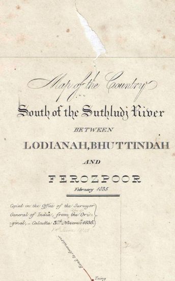
- PUNJAB Map of the country South of the Suthludj River between Lodianah Bhuttindah, and ferozepoor, Surveyed in 1835. Copied by Shaikh Khadem Ally in 1835.
- Department: Survey Of India (Maps)
- Year: 1835
- Place : Punjab
- Digitized Collection : Digitized Cartographic Records
- Held by : National Archives of India
- Date of Upload: 2018-01-06
- 1063 Views
-
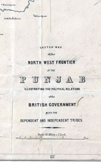
- PUNJAB Sketch map of the North West Frontier of the Punjab, illustrating the Political relations of the British Government with the Dependent and Independent Tribes . Drawn by J.O.N James.1866.
- Department: Survey Of India (Maps)
- Year: 1866
- Place : Punjab
- Digitized Collection : Digitized Cartographic Records
- Held by : National Archives of India
- Date of Upload: 2018-01-06
- 886 Views
-
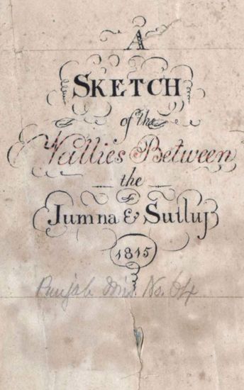
- PUNJAB Sketch of th valllies between jumna and Sutluj. 1815.
- Department: Survey Of India (Maps)
- Year: 1815
- Place : Punjab
- Digitized Collection : Digitized Cartographic Records
- Held by : National Archives of India
- Date of Upload: 2018-01-06
- 806 Views
-
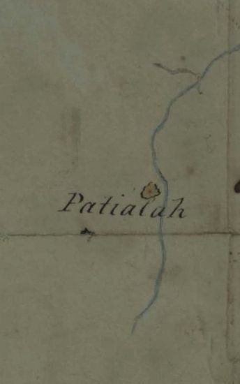
- PUNJAB Route of Col. Ochterlony From Loodianah Down the Hill Frontier in Nov.1813.(Also shows the positions of the Goorkhas)1813.
- Department: Survey Of India (Maps)
- Year: 1813
- Place : Punjab
- Digitized Collection : Digitized Cartographic Records
- Held by : National Archives of India
- Date of Upload: 2018-01-06
- 318 Views
-
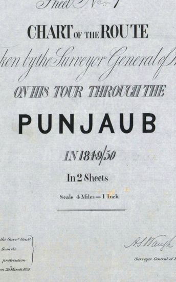
- PUNJAB Chart of the Route taken by the Surveyor General of India on his tour Through the Punjab . By Lt. Col A.s. Waugh 1849/50. Copied from the Original by William C. Bolst in 1851.
- Department: Survey Of India (Maps)
- Year: 1851
- Place : Punjab
- Digitized Collection : Digitized Cartographic Records
- Held by : National Archives of India
- Date of Upload: 2018-01-06
- 349 Views
-
- PUNJAB Route of the Field under Brigadier Arnold. G.B. on the Scikh frontier .Survyed by Lt. J. Colvin 1818.Copied by T. Lockwood.
- Department: Survey Of India (Maps)
- Year: 1818
- Place : Punjab
- Digitized Collection : Digitized Cartographic Records
- Held by : National Archives of India
- Date of Upload: 2018-01-06
- 329 Views
-
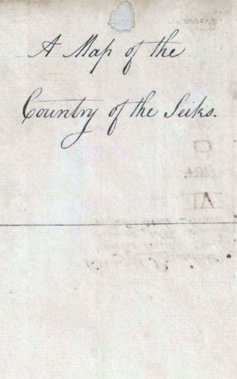
- PUNJAB Sketch map of the country of the Sikhs . By Lt. Rind 1789.
- Department: Survey Of India (Maps)
- Year: 1789
- Place : Punjab
- Digitized Collection : Digitized Cartographic Records
- Held by : National Archives of India
- Date of Upload: 2018-01-06
- 406 Views
-
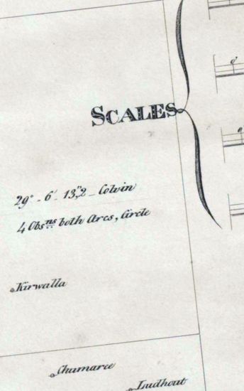
- PUNJAB Route of the Field under Brigadier Arnold. G.B on the Scikh Frontier .Surveyed By Lt. J. Colvin. 1818. Copied by G.K Hudson in 1830..
- Department: Survey Of India (Maps)
- Year: 1818
- Place : Punjab
- Digitized Collection : Digitized Cartographic Records
- Held by : National Archives of India
- Date of Upload: 2018-01-06
- 220 Views
-
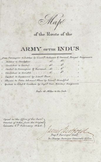
- PUNJAB Map of the Route of the Army of the Indus. Copied in 1841.
- Department: Survey Of India (Maps)
- Year: 1841
- Place : Punjab
- Digitized Collection : Digitized Cartographic Records
- Held by : National Archives of India
- Date of Upload: 2018-01-06
- 250 Views
-

- PUNJAB The marches from Rohtak to Nabha of the 2nd Battalion, 10th Regiments and of Detachment from it surveyed by Lt.J.A Hondgson,1809.
- Department: Survey Of India (Maps)
- Year: 1809
- Place : Punjab
- Digitized Collection : Digitized Cartographic Records
- Held by : National Archives of India
- Date of Upload: 2018-01-06
- 212 Views
-
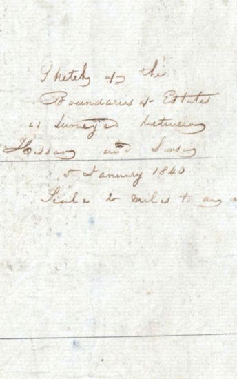
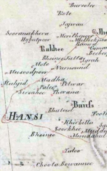
- PUNJAB Sketch of the boundaries of Estates surveyed between Hissar and Sirsa.1840.
- Department: Survey Of India (Maps)
- Year: 1840
- Place : Punjab
- Digitized Collection : Digitized Cartographic Records
- Held by : National Archives of India
- Date of Upload: 2018-01-06
- 259 Views
-
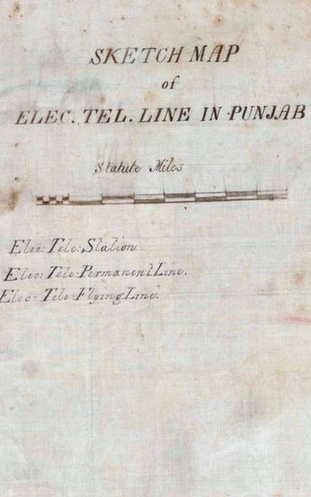
- PUNJAB Sketch map of Electric telegraph line in punjab .1872.
- Department: Survey Of India (Maps)
- Year: 1872
- Place : Punjab
- Digitized Collection : Digitized Cartographic Records
- Held by : National Archives of India
- Date of Upload: 2018-01-06
- 263 Views
-
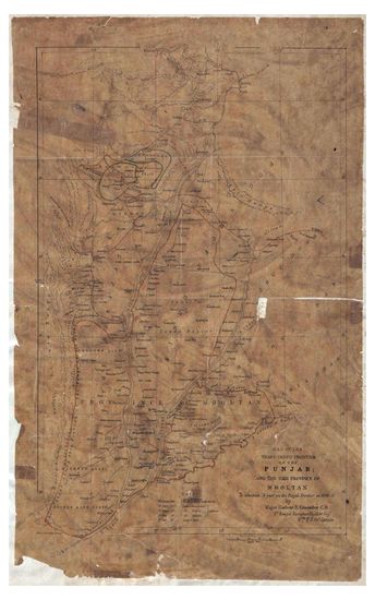
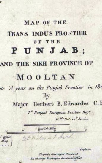
- PUNJAB Map of the Trans-Indus Fronteir of Punjab and the Sikh Province of Mooltan, to illustrate, A year on the Punjab Survey frontier in 1848-49 Suveyed by Maj Herbert B.Edwards, 1848-49.
- Department: Survey Of India (Maps)
- Year: 1848
- Place : Punjab
- Keywords : Herbert B. Edwardes
- Digitized Collection : Digitized Cartographic Records
- Held by : National Archives of India
- Date of Upload: 2018-01-06
- 488 Views
-
- PUNJAB Map of the Trans.Indus Frontier of th ePunjab and the sikh Province of Mooltan, to illustrate A year on the Punjab Survey Frontier in 1848-49Copied from Arrowsmith map in 1851.
- Department: Survey Of India (Maps)
- Year: 1848
- Place : Punjab
- Digitized Collection : Digitized Cartographic Records
- Held by : National Archives of India
- Date of Upload: 2018-01-06
- 424 Views
-
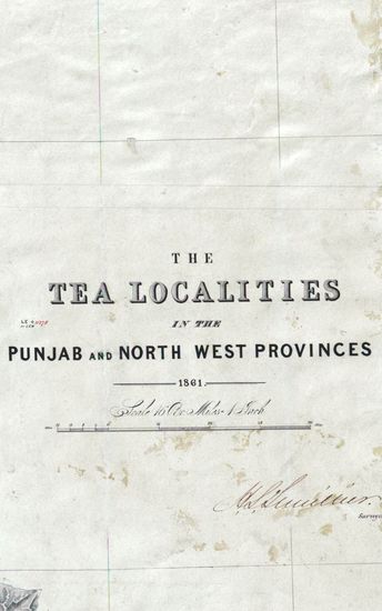
- PUNJAB The Tea localities in the punjab and North West Province.Compiled by J.P Namey 1861.
- Department: Survey Of India (Maps)
- Year: 1861
- Place : Punjab
- Digitized Collection : Digitized Cartographic Records
- Held by : National Archives of India
- Date of Upload: 2018-01-06
- 191 Views
-
- 2920 Views
- PUNJAB Map of the Norethern Frontier of British In...
- Department: Survey Of India (Maps)
- Year: 1844
-
- 1063 Views
- PUNJAB Map of the country South of the Suthludj Ri...
- Department: Survey Of India (Maps)
- Year: 1835
-
- 886 Views
- PUNJAB Sketch map of the North West Frontier of th...
- Department: Survey Of India (Maps)
- Year: 1866
-
- 806 Views
- PUNJAB Sketch of th valllies between jumna and Sut...
- Department: Survey Of India (Maps)
- Year: 1815
-
- 318 Views
- PUNJAB Route of Col. Ochterlony From Loodianah Dow...
- Department: Survey Of India (Maps)
- Year: 1813
-
- 349 Views
- PUNJAB Chart of the Route taken by the Surveyor Ge...
- Department: Survey Of India (Maps)
- Year: 1851
-
- 329 Views
- PUNJAB Route of the Field under Brigadier Arnold. ...
- Department: Survey Of India (Maps)
- Year: 1818
-
- 406 Views
- PUNJAB Sketch map of the country of the Sikhs . By...
- Department: Survey Of India (Maps)
- Year: 1789
-
- 220 Views
- PUNJAB Route of the Field under Brigadier Arnold. ...
- Department: Survey Of India (Maps)
- Year: 1818
-
- 250 Views
- PUNJAB Map of the Route of the Army of the Indus. ...
- Department: Survey Of India (Maps)
- Year: 1841
-
- 212 Views
- PUNJAB The marches from Rohtak to Nabha of the 2nd...
- Department: Survey Of India (Maps)
- Year: 1809
-
- 259 Views
- PUNJAB Sketch of the boundaries of Estates surveye...
- Department: Survey Of India (Maps)
- Year: 1840
-
- 263 Views
- PUNJAB Sketch map of Electric telegraph line in pu...
- Department: Survey Of India (Maps)
- Year: 1872
-
- 488 Views
- PUNJAB Map of the Trans-Indus Fronteir of Punjab a...
- Department: Survey Of India (Maps)
- Year: 1848
-
- 424 Views
- PUNJAB Map of the Trans.Indus Frontier of th ePunj...
- Department: Survey Of India (Maps)
- Year: 1848
-
- 191 Views
- PUNJAB The Tea localities in the punjab and North ...
- Department: Survey Of India (Maps)
- Year: 1861