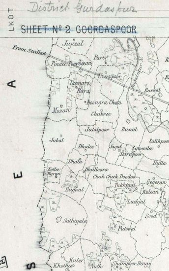
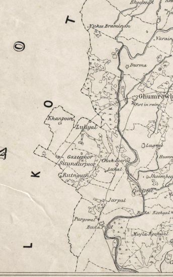
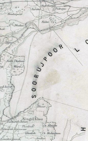
Kashmir Size 51.1 cm x 63. 3 cm, between borders; in sigle sheet. Latitudes 32030’N and 330N and longitudes from 770E to 780E marked and numbered; hand- drawn and coloured; boundaries ribbon- coloured; heights of passes marked; boundary pillars also shown; bridges on the rivers, sites of temples and hot springs marked; relief shown in grey tint and peaks of mountainranges shown by vertical hechures; routes in single lines and also in broken single lines of burnt sienna; graticules and lines of bearings, in pencil, marked; contains ‘calculations’ of coordinates of some places in pencil with signature [illegible]; bears two ramarks – “Orig1. Of this Recd.- 14th Oct. / 48”. from Foreign Dept. and returned thereto 4th Nov ./ 48”. In pencil and “(Original Recd. 27th Decr . 1847 in Foreign Dept.) “ in ink and bears the signatures, also in ink, of Capt. H. L. Thuillier, Deputy Surveyor General. Watermark: “J WHATMAN 1847”.
| Department | Survey Of India (Maps) |
| Place | Kashmir |
| Series | Cartographic Notes |
| Identifier | CR_000002286630 |
| File No. | 1841-60-34 |
| Scale | 51.1 cm x 63. 3 cm |
| File Size | 3.9 MB |
| Pages | 1 |
| Collection | Digitized Cartographic Records |
| Series | Cartographic Notes |
-
393 views
Other Similar Items
-
- 301 Views
- Hyderabad Size of the map , in 5 sections, is 110 ...
- Department: Survey Of India (Maps)
-
- 356 Views

- Hyderabad Size of the map , in 5 sections, is 110 ...
- Department: Survey Of India (Maps)
-
- 640 Views

- Bengal Size:86cmx98.5cm,between borders; 2 sheets,...
- Department: Survey Of India (Maps)
-
- 285 Views
- Khandesh Size 210cm x 189.5cm , actual areas, 10 s...
- Department: Survey Of India
-
- 316 Views
- Hyderabad Size of the map , in 5 sections, is 110 ...
- Department: Survey Of India (Maps)
-
- 354 Views

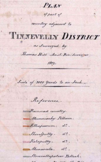
- Tinnevelly Size: 80 cm x 96cm,actual area; five sh...
- Department: Survey Of India (Maps)
- Year / Date: 1810
-
- 300 Views
- Tinnevelly Size: 57 cm x 65 cm , actual area; two ...
- Department: Survey Of India
- Year / Date: 1813
-
- 229 Views
- Hoshiarpur Size of each section: 50.8 cm x 91. 0 c...
- Department: Survey Of India (Maps)
-
- 251 Views
- Hoshiarpur Size of each section: 50.8 cm x 91. 0 c...
- Department: Survey Of India (Maps)
-
- 240 Views
- Hoshiarpur Size of each section: 50.8 cm x 91. 0 c...
- Department: Survey Of India (Maps)