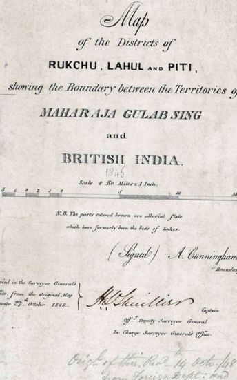
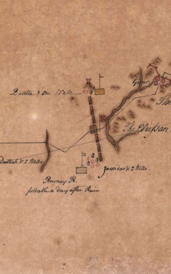
Khandesh Size 210cm x 189.5cm , actual areas, 10 sheets pasted together and then sectioned into 8 sections ; latitudes 21 N to 25 N and longitudes 73 E to 77 15 'E marked and numbered ; hand -drawn in ink and sparsely coloured ; some boundaries ribbon- coloured and some areas tinted ; a few place-names written in rough hand; rivers coloured grey; towns shown in rectangular shapes in red; releif shown by tint and rough spray of grey and at some places vertical hechures with brush,also of grey; routes shown in single lines of burnt sienna ; scale deduced by comparison. This map is a 'Rough Original draft. Sheets contain four watermarks : (1) J WHATMAN TURKEY MILLS 1818 (2)'Bend' with 'Monograme' and I ring 1808 and 'Fleur-de-Lis ' and (4) J WHATMAN 1817.
| Ministry/ Department/ Residency | Survey Of India |
| Place | Khandesh |
| Series | Cartographic Notes |
| Identifier | CR_000002286462 |
| File No./Reference No./Sheet No./Folio No. | 1801-20-7 |
| Scale | 210cm x 189.5cm |
| File Size | 2.9 MB |
| Pages | 1 |
| Collection | Digitized Cartographic Records |
| Series | Cartographic Notes |
-
292 views
Other Similar Items
-
- 357 Views

- Dindigul Sizes of various sections very between 33...
- Department: Survey Of India (Maps)
-
- 396 Views
- Kashmir Size 51.1 cm x 63. 3 cm, between borders; ...
- Department: Survey Of India (Maps)
-
- 256 Views

- Goa size: 89 cm x 61 cm, between borders ; in one ...
- Department: Survey Of India
- Year / Date: 1814-05-29
-
- 349 Views
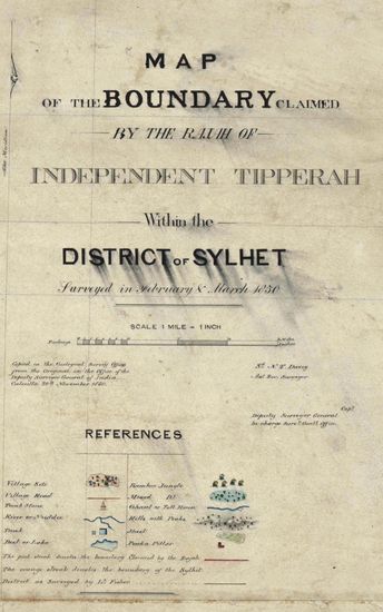
- Sylhet Size: 98.3 cm x 91.5 cm, between borders; i...
- Department: Survey Of India (Maps)
-
- 316 Views

- Tinnevelly Size: 79 cm x 57.5 cm , actual areas th...
- Department: Survey Of India (Maps)
- Year / Date: 1805
-
- 620 Views
- Jabalpur Size: 67.0 cm x 101.0 cm, actual area; in...
- Department: Survey Of India (Maps)
-
- 158 Views
- Goa Size; 17 cm x31.5 cm, actual area; in one shee...
- Department: Survey Of India
- Year / Date: 1811-05-18
-
- 197 Views
- Gwalior Size: 59.5 cm x 50.3 cm, actual area; in t...
- Department: Survey Of India (Maps)
-
- 235 Views

- Goa Size: 91.5 cm x62.5 cm, betwwen borders; in on...
- Department: Survey Of India
- Year / Date: 1811
-
- 480 Views
- India Size: Twenty three sections of 38cm x54cm,ac...
- Department: Survey Of India (Maps)